


Design and access statement
Note:
From 25 June 2013, design and access statements are only required for buildings of more than 1,000 sq. m, housing developments of 10 dwellings or more and developments requiring listed building consent. In conservation areas, design and access statements are required for single dwellings or buildings of more than 100 sq. m.
Requirements for design and access statements must also be proportionate to the scale of the proposed development, and any information requests must be necessary to validate the application. Applicants are allowed to challenge demands that they think are unnecessary and local authorities then either have to justify the demand or waive it.
For more information see The Town and Country Planning (Development Management Procedure) (England) (Amendment) Order 2013.
Design and access statements are prepared as part of the documentation to support a planning application. They explain the design principles and concepts that have been applied to particular aspects of the proposed development. Design and access statements may include plans, elevations and other illustrations, photographs and for large or complex schemes a model of the proposed development.
Design and access statements should explain:
- Amount (how much development is proposed). For residential development, this the number of proposed units and for all other development, the proposed floor space for each proposed use.
- Layout:
- The relationship between buildings and public and private spaces within and around the site.
- Accessibility of the site for users, such as travel distances and gradients, and the orientation of blocks and units in relation to any site topography to afford optimum accessibility.
- The impact of the layout on the energy consumption and thermal comfort during winter and summer performance.
- Crime prevention measures.
- Scale:
- The height, width and length of a building or buildings in relation to its surroundings.
- The size of building parts, particularly entrances and facades.
- Why particular heights have been selected.
- How these relate to the site’s surroundings and skyline.
- How they relate to the human scale.
- Purpose of landscaping private and public spaces.
- Its relationship to the surrounding area.
- A schedule of planting and landscaping materials.
- Appearance of the development:
- The appearance of the place or buildings proposed.
- How this relates to the appearance and character of the development’s surroundings.
- How the decisions about texture, contrast, tone and lighting have considered accessibility.
- Context:
- Steps taken to understand the local context (physical, social and economic characteristics as well as planning policies).
- How local context has influenced the design.
- Consultation with the local community and local access groups as well as with local authority planning, building control, conservation and design and access officers. Explanation of how these views have been take into account.
- Opportunities, constraints and conflicting issues.
- Use:
- Proposed use or uses.
- Their distribution across the site.
- Accessibility to and between them.
- Their relationship to uses surrounding the site.
- Access (access to the development, not internal aspects of buildings):
- Access to buildings, spaces and transport.
- Flexibility and responsiveness to changing needs.
- Any consultation undertaken.
- Access for emergency services if appropriate.
NB: The National Planning Policy Framework makes clear that there should be a presumption in favour of sustainable developments. This should be reflected in design and access statements.
[edit] Related articles on Designing Buildings
- Building regulations.
- Constraints.
- Detailed planning application.
- Outline planning application.
- National Planning Policy Framework.
- Planning permission.
- Statutory approvals.
- Sustainability.
[edit] External references
Featured articles
Check out some of the best features and news from Designing Buildings as well as key stories from around the web.
Construction Management, 8 July

NEETs crisis drives interest in trades, but apprenticeships barriers remain.
Passive fire protection webinar

MEP services penetration seals.

Where its at podcast (and video) - The role of the Architectural Technologist as an Expert Witness.

More than 200 remarkable buildings added to SAVE’s Buildings at Risk register.
Government scraps pre-application consultation for Nationally Significant Infrastructure Projects.
Historic England and infrastructure
New projects offer opportunities for the historic environment and local communities.
Construction Management, 2 July
Construction deaths halve in two years.
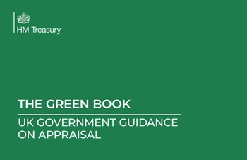
Green Book changes to drive investment in all parts of UK.
Minimum energy efficiency standards (MEES)
![]()
CIAT briefing on response to consultations for privately rented non-domestic properties.
Connect, collaborate, shape the future

Registration now live for UK Construction Week Birmingham.
![]()
CIOB announces Saul Humphrey FCIOB as new President for 26/27 term.
![]()
A quick, simple, and zero-bills solution to prevent overheating.
Comments
http://www.legislation.gov.uk/uksi/2013/1238/article/4/made
This says 'the provision of a building or buildings where the floor space created by the development is 100 square metres or more.' Not 1000sqm.
Is this an error?
That is only in designated areas - ie conservation areas.